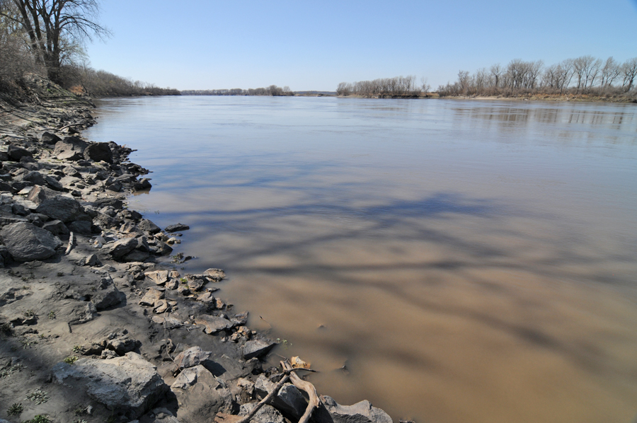
McIlwaine's Bend, Missouri River, Miami, MO
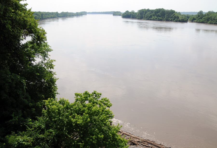
McIlwaine’s Bend on the Missouri River is mentioned in the section heading to Doctrine and Covenants section 61. The Prophet Joseph Smith received that revelation there on August 12, 1831. However, as a geographic feature, the bend no longer exists as it once did. Over the years, the course of the Missouri River has been altered by engineers to straighten and deepen it. This allows river traffic to use this waterway with greater freedom to navigate and fewer accidents. As the man-made changes were completed, Mother Nature took over from there. Sharp and shallow turns in the river were straightened and deeper water reduced the number of times that river vessels got stuck.
As the shallow spots, hairpin turns, sandbars and other hazards disappeared, so did McIlwaine’s Bend, at least as it was when Joseph Smith passed there. At other sites along the river such as Independence, MO, the Missouri River has moved sometimes more than a half mile from its 1831 route.
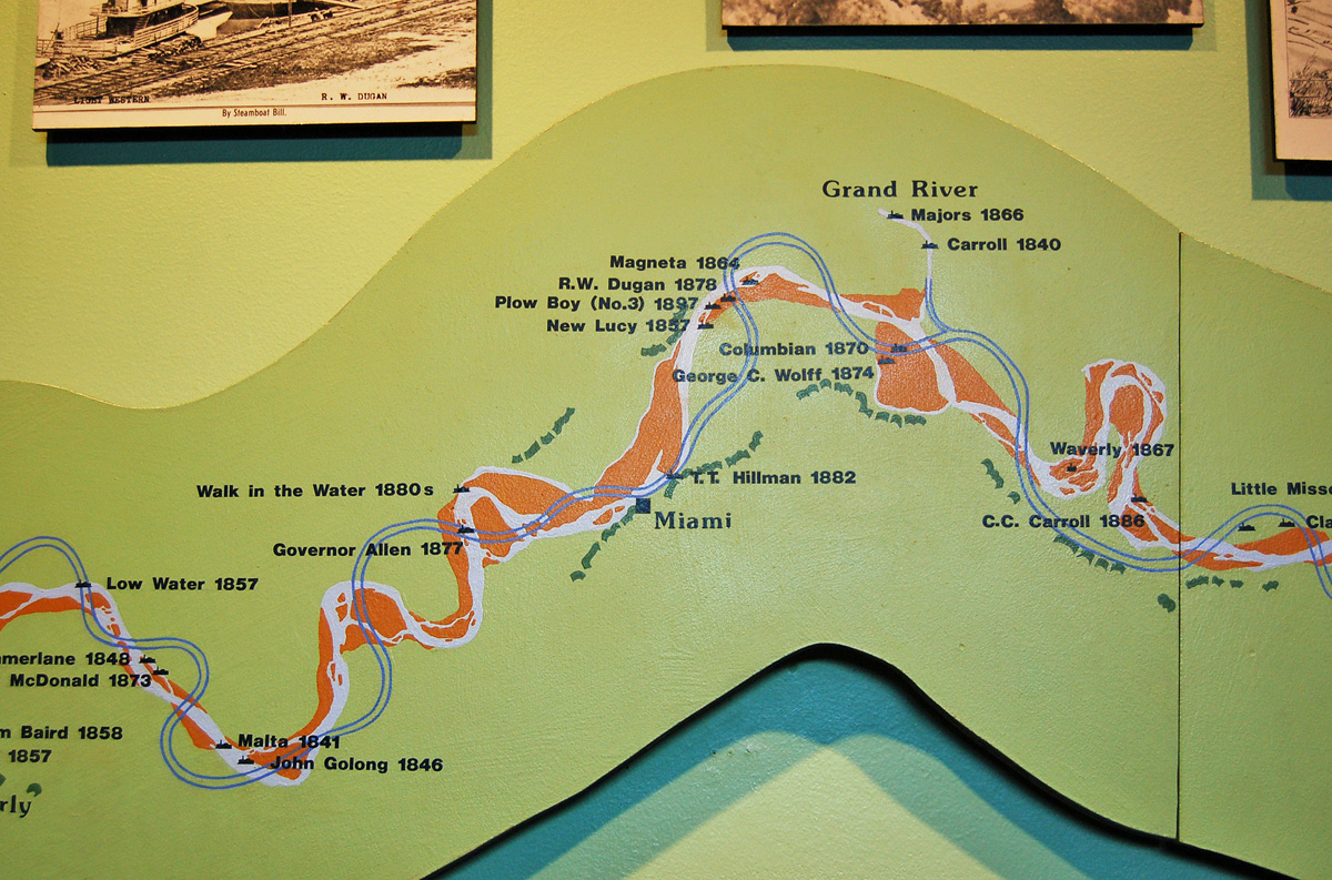
The site of McIlwaine’s Bend as the place where the revelation (Doctrine and Covenants 61) was given has been determined by Missouri scholar Max H Parkin: “The name ‘McIlwaine’s Bend’ was not used by the U. S. Corp of Engineers, which surveyed the river in 1878 and recorded the name of each bend.” Parkin explains that Latter-day Saint sources, however, identify the approximate area of the site as being about 100 miles east of Independence, MO, likely between Miami, MO and Teteseau Bend, five miles west of the Miami Bridge.

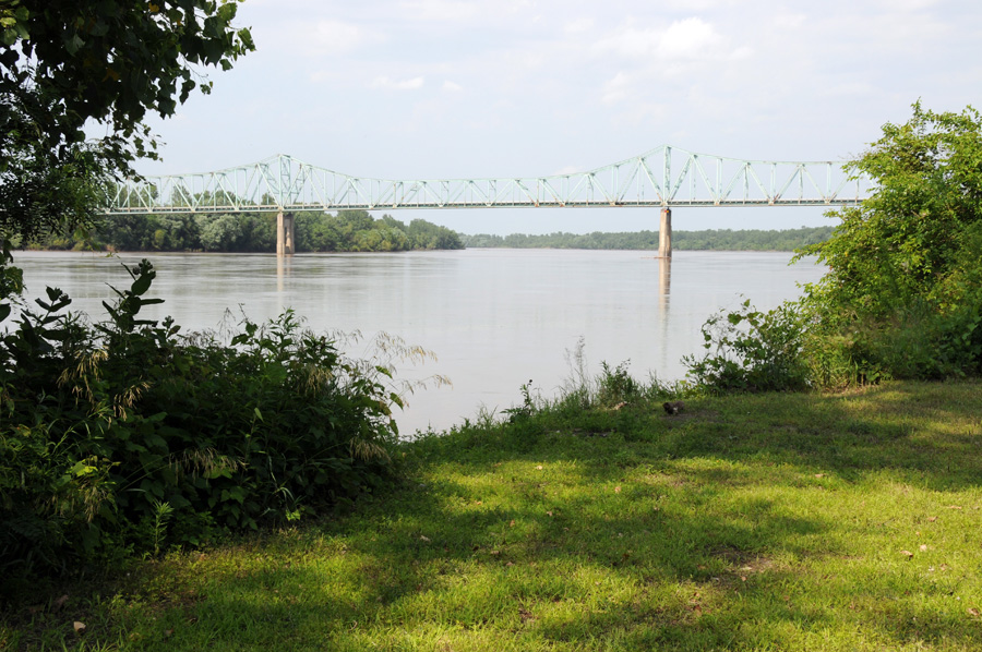
LaMar C. Berrett reaffirms that Miami, Missouri is the approximate site of where McIlwaine’s Bend was situated when Joseph Smith passed by in 1831. The little town of Miami, MO is on the south side of the river in Saline County. Presently, the river serves as the county line separating Saline from Carroll County to the north. The best place to view the river is from the public boat ramp at Miami.
Map and Directions
Ownership Status
The boat launch and parking area at Miami, Missouri are owned and maintained by the Missouri Conservation Department. It is open to the public every day from 4:00 am to 10:00 pm. There is no charge to visit or use the site.
Photos
Articles & Resources
Resources
Max H Parkin, in LaMar C. Berrett, ed., Sacred Places, Vol. 4, 139-140, 505.
Alexander Baugh, in Brandon S. Plewe, ed., Mapping Mormonism: An Atlas of Latter-day Saint History, 38.
Ivan J. Barrett, Joseph Smith and the Restoration: A History of the LDS Church to 1846, 192.